Start with the community closest to your parcel. Each guide explains a different local access, channel, drainage or jurisdiction question.
Your part of the coast
Explore the coast. Find your starting point.
From the Anclote waterfront to Hudson and Aripeka, find the local records and questions that fit your waterway.
Full local guide
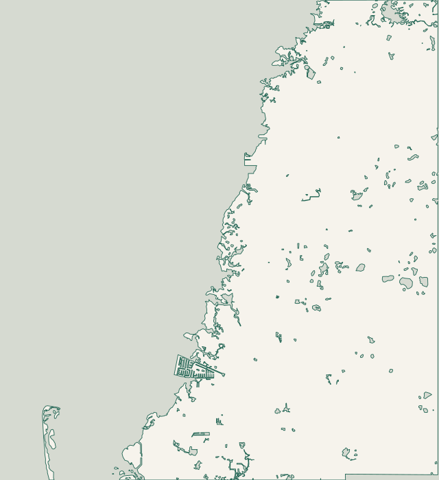
Choose a label to open local resources →Tap a community on the map or below ↗
Geography: U.S. Census county and water records; community points: Pasco GIS. Checked October 25, 2026. Orientation only; not a parcel survey, flood map or navigation chart. Some narrow canals are not shown.
Your local starting point
Find your community.
Choose a guide for local maps, permit starting points and the records to gather for your property.
The Cotee River connects New Port Richey’s riverfront neighborhoods with the Gulf. Sims Park and James E. Grey Preserve sit along that corridor, while the broader New Port Richey mailing area extends beyond city limits. A property near an upstream preserve can have different access and shoreline conditions from a downtown riverfront lot.
Gulf Harbors includes waterfront plats recorded as Flor-A-Mar and Gulf Harbors South Beach. Its extensive canal network developed during the 1960s and 1970s, but that history does not date an individual seawall. North Main, South Main, Cross Bayou and the connected Woodlands, Sea Forest and Jobeth Drive channels appear separately in county engineering records.
The Woodlands and Sea Forest channel joins Gulf Harbors North Main near the yacht club. County engineering records distinguish bends around Rickover Court, Cross Bayou and Jobeth Drive. Gulf Harbors Woodlands identifies itself as unincorporated, while Gulf Landings serves several separate communities. Check the individual parcel instead of assigning one jurisdiction or association to every Sea Forest Drive address.
The Cotee River reaches the coast through Port Richey, with Millers Bayou adding a different waterfront setting nearby. The city lists Nick’s Park as its only motorboat ramp and Waterfront Park as a kayak launch. These distinctions matter when discussing access, but neither park listing provides permission to stage a private construction project.
The county’s Hudson Beach study separates Hudson Main Channel, Sponge Crawl Creek near Clark Street and Harbor Drive Channel. Hudson Beach Estates, Sea Ranch on the Gulf and Pleasure Isles also appear as distinct recorded subdivisions. These names help locate a project, but they do not establish a wall’s condition, current water depth or equipment clearance.
Signal Cove and Leisure Beach connect residential canal frontage with routes shaped by mangroves, park land and existing docks. The county’s 2020 study treats Signal Cove Main, Signal Cove South and Leisure Beach’s east and west corners separately. That detail matters: a constraint at one corner should not be copied onto every nearby property.
The March 2026 county study describes about 3.2 miles of Sea Pines residential canals and a 2.9-mile entrance channel toward the Nature Coast Aquatic Preserve. Interior canals are largely seawalled, with projecting docks influencing available space. Those network dimensions describe the study area, not the usable depth or access clearance at any particular home.
County records identify Coral Cove and Driftwood Isles as separate subdivisions, while the public channel program groups them together. The published Coral Cove engineering report evaluates an entrance segment and five interior branches. Its findings are useful for Coral Cove planning, but do not establish sediment, rock or depth conditions at an unexamined Driftwood Isles property.
Aripeka sits at the Pasco-Hernando county line, where Hammock Creek connects a spring system with the Gulf. Boat, Magnolia and Aripeka 1 and 2 springs feed the creek. The District describes freshwater swamps adjoining its saltwater estuary, so a waterfront address alone does not describe the bank, vegetation or conditions at the proposed work.
Key Vista Nature Park on Baillie’s Bluff Road helps show the variety of nearby waterfronts: its management plan describes Gulf frontage plus shoreline along Rocky Creek and Sleepy Lagoon. Anclote Gulf Park adjoins Key Vista, while Anclote River Park is a separate facility. Use these landmarks to locate the property without treating each shoreline as the same construction setting.
The county’s West Port study locates the subdivision west of US 19 and north of Westport Drive, with access toward Seabreeze Drive. It covers seven finger canals beside streets including Island Harbor, Tradewinds and the San Sierra, San Mateo, San Sebastian and San Diego corridors. West Port is distinct from the incorporated City of Port Richey.
County mapping identifies Green Key Estates and Green Key Beach, while the state coastal map names Oyster Creek, Wigwam Creek and Big Bayou nearby. The wider Oyster Bayou area also appears in city flood-outreach planning. These overlapping names help orient a project, but do not establish that every nearby property is waterfront or outside New Port Richey’s city limits.