Green Key and Oyster Bayou shoreline repair
Trace water through the property before deciding what to rebuild. This corridor combines coastal drainage, natural water edges and properties with different local permit authorities.
Describe your project on this page ↓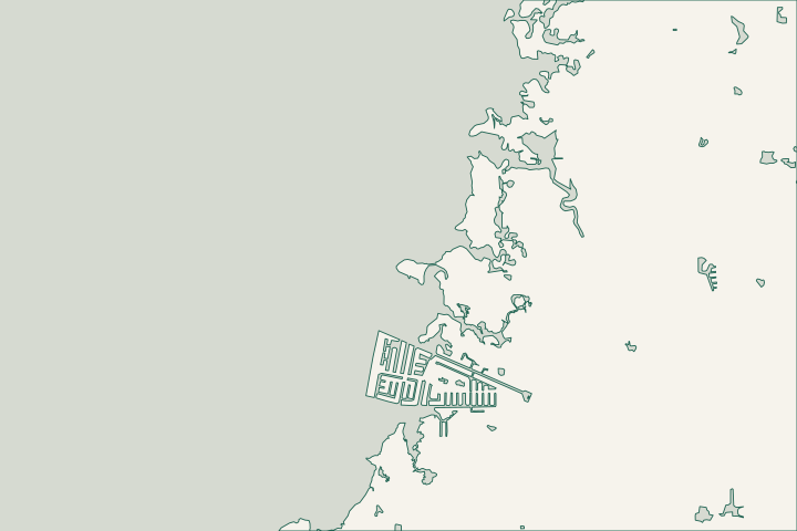
What the Rees Park project can teach
FDEP’s FY2021–22 award supported native planting across about 1,000 square feet of lower upland beach at Robert K. Rees Memorial Park.
Consider the type of shoreline
The public planting project shows a locally considered stabilization approach. It does not establish a substitute for a structural wall at every private lot.
Coastal Partnership Initiative Project Abstracts FY 2021-2022
Match records to the address
Save the survey, parcel jurisdiction and photographs of the actual water edge together. Green Key and Oyster Bayou labels alone cannot select the permit office.
Pasco County Boundaries: Subdivision layer · Building Division
Creeks, bayous and the coastal corridor
County mapping identifies Green Key Estates and Green Key Beach, while the state coastal map names Oyster Creek, Wigwam Creek and Big Bayou nearby. The wider Oyster Bayou area also appears in city flood-outreach planning. These overlapping names help orient a project, but do not establish that every nearby property is waterfront or outside New Port Richey’s city limits.
Pasco County Boundaries: Subdivision layer · Florida Circumnavigational Saltwater Paddling Trail: Segment 7 Map Book · Flood Risk and Preparedness Public Information Committee
Work outward from the outlet
When water collects behind a wall, record its source and timing. Mark visible pipes, low points, yard depressions and the route toward the street. Ask whether the problem concerns a damaged structure, blocked outlet, runoff from elsewhere or several conditions together.
The city’s February 2025 drainage update records a broken-pipe replacement on Green Key Road during FY2023. That historical repair shows why street drainage belongs in the conversation; it does not identify the owner or present condition of the outlet at your lot. 10-Year Update: Stormwater Master Drainage Plan, February 2025
Read adaptation plans as options
The 2024 vulnerability assessment proposes an area between the Gulf and US 19, from Sleighbell Lane south to Green Key Road. It considers additional storage in existing or new ponds and backflow-control options where feasible. These are planning concepts, not a scheduled fix, parcel flood map or instruction to install a valve in every seawall. New Port Richey Vulnerability Assessment, September 2024 New Port Richey Vulnerability Assessment, September 2024
The city also names Oyster Bayou and nearby subdivisions as priorities for flood outreach. Use that context to request current property information rather than assuming a neighborhood-wide flood zone or damage level. Flood Risk and Preparedness Public Information Committee
Resolve the parcel and drainage authority
| Starting point | What to resolve | Prepare and look up |
|---|---|---|
New Port Richey or Pasco County | Choose the local permit office from the parcel boundary. | City: 727-853-1047. Unincorporated county: 727-847-8126, option 5. |
Flood / drainage review | Existing and proposed elevations, runoff routes and outlets. | For county parcels, ask whether a drainage plan applies even outside a Special Flood Hazard Area. |
Environmental review | Applicable natural-shoreline and waterway authorization. | Show existing vegetation, bank condition, wall alignment and the entire work area. |
Separate the wall from drainage changes
Ask for an estimate that separates wall stabilization, outlet investigation, any engineered drainage change and landscape restoration. A taller cap alone should not be priced as a complete solution before the water route is understood.
Published planning ranges, not a quote. Confirm design, permits, removal, access and restoration in the final proposal.
Compare quotes and plan a budget →Describe the water and shoreline problem
Share the street, existing wall or bank condition and whether water appears after rainfall, high tides or both.
A clear next step for your waterfront.
Green Key & Oyster Bayou Corridor project questions
Is the Rees Park award a grant for my seawall?
No. The cited award was for a specific public park planting project. It does not establish private homeowner funding or completion of all planned work.
Coastal Partnership Initiative Project Abstracts FY 2021-2022
Does Oyster Bayou’s outreach priority establish my flood zone?
No. Use current parcel mapping and the appropriate local office. The city’s outreach list identifies an area for education, not a property-specific determination.
Keep planning
Nearby waterfront guides
New Port Richey & the Cotee River, Gulf Harbors / Flor-A-Mar, Woodlands, Sea Forest & Gulf Landings
Show sourcesHide sources
- Pasco County Boundaries: Subdivision layerSource reviewed 2026-10-25
- Florida Circumnavigational Saltwater Paddling Trail: Segment 7 Map BookSource reviewed 2026-10-25
- Flood Risk and Preparedness Public Information CommitteeSource reviewed 2026-10-25 · official indexed text
- 10-Year Update: Stormwater Master Drainage Plan, February 2025Source reviewed 2026-10-25 · official indexed text
- New Port Richey Vulnerability Assessment, September 2024Source reviewed 2026-10-25 · official indexed text
- Building DivisionSource reviewed 2026-10-25 · official indexed text
- DevelopmentSource reviewed 2026-10-25
- Building ConstructionSource reviewed 2026-10-25
- Lot Grading and Drainage PlanSource reviewed 2026-10-25
- Southwest District PermittingSource reviewed 2026-10-25
- Coastal Partnership Initiative Project Abstracts FY 2021-2022Source reviewed 2026-10-25